 ar
ar bg
bg hr
hr cs
cs da
da nl
nl fi
fi fr
fr de
de el
el hi
hi it
it ko
ko no
no pl
pl pt
pt ro
ro ru
ru es
es sv
sv tl
tl iw
iw id
id lv
lv lt
lt sr
sr sk
sk sl
sl uk
uk vi
vi et
et hu
hu th
th tr
tr fa
fa ms
ms hy
hy ka
ka ur
ur bn
bn mn
mn ta
ta kk
kk uz
uz ku
ku
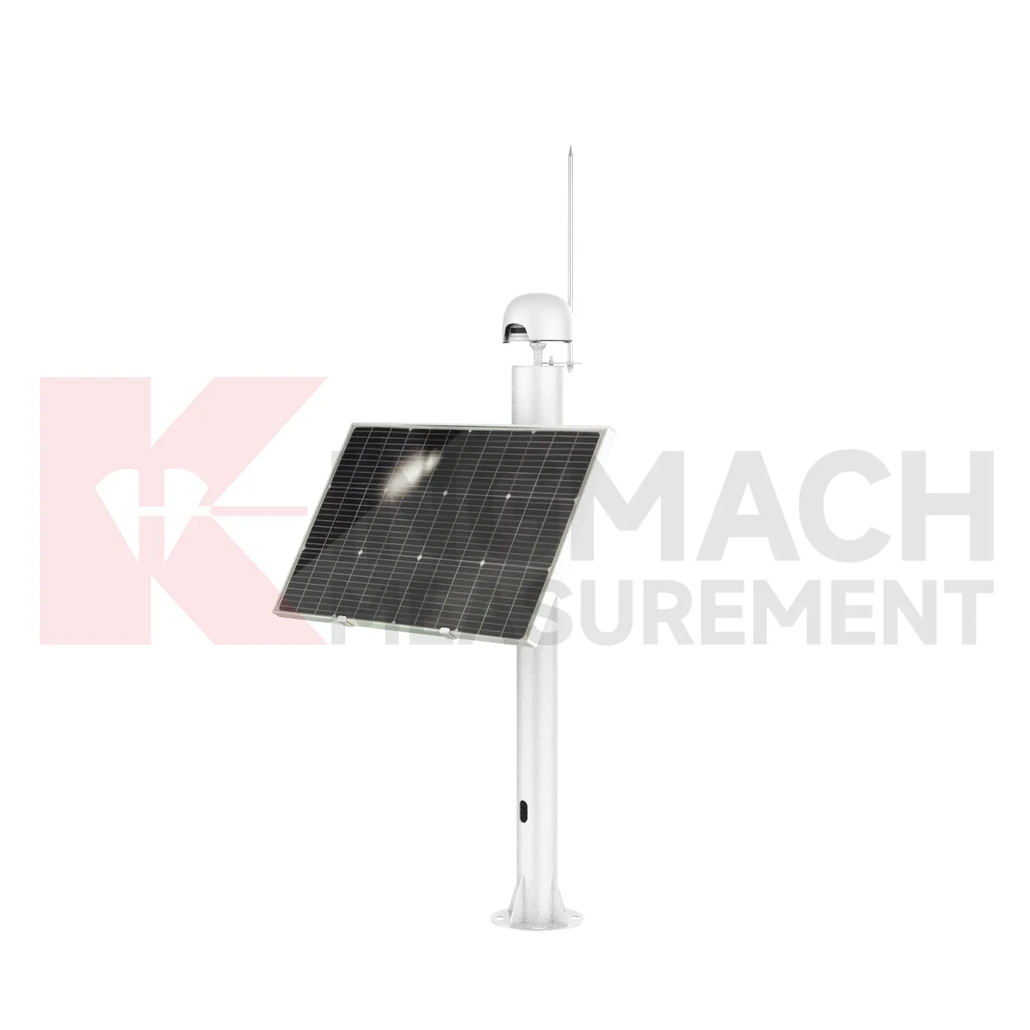
Integrated GNSS
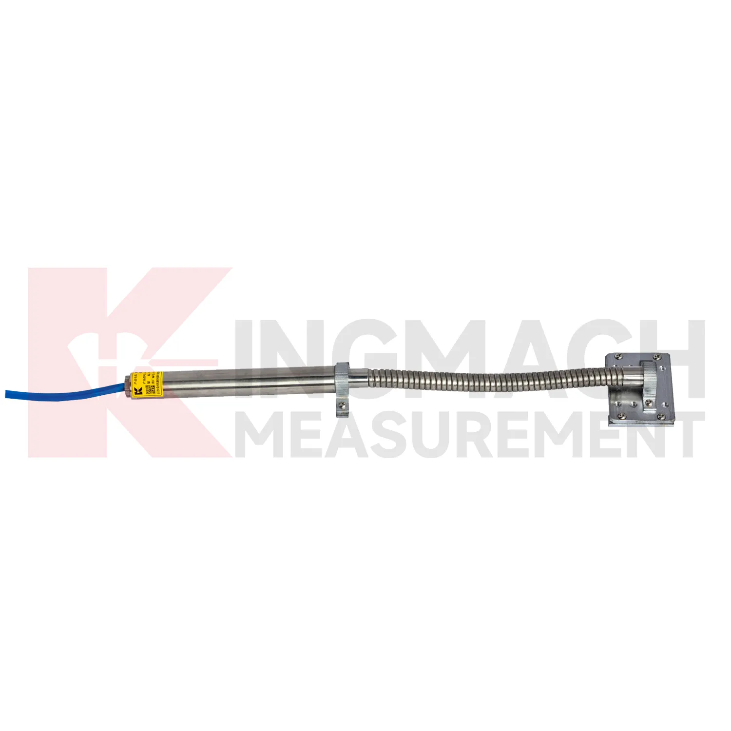
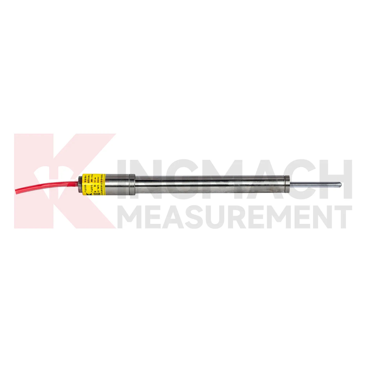
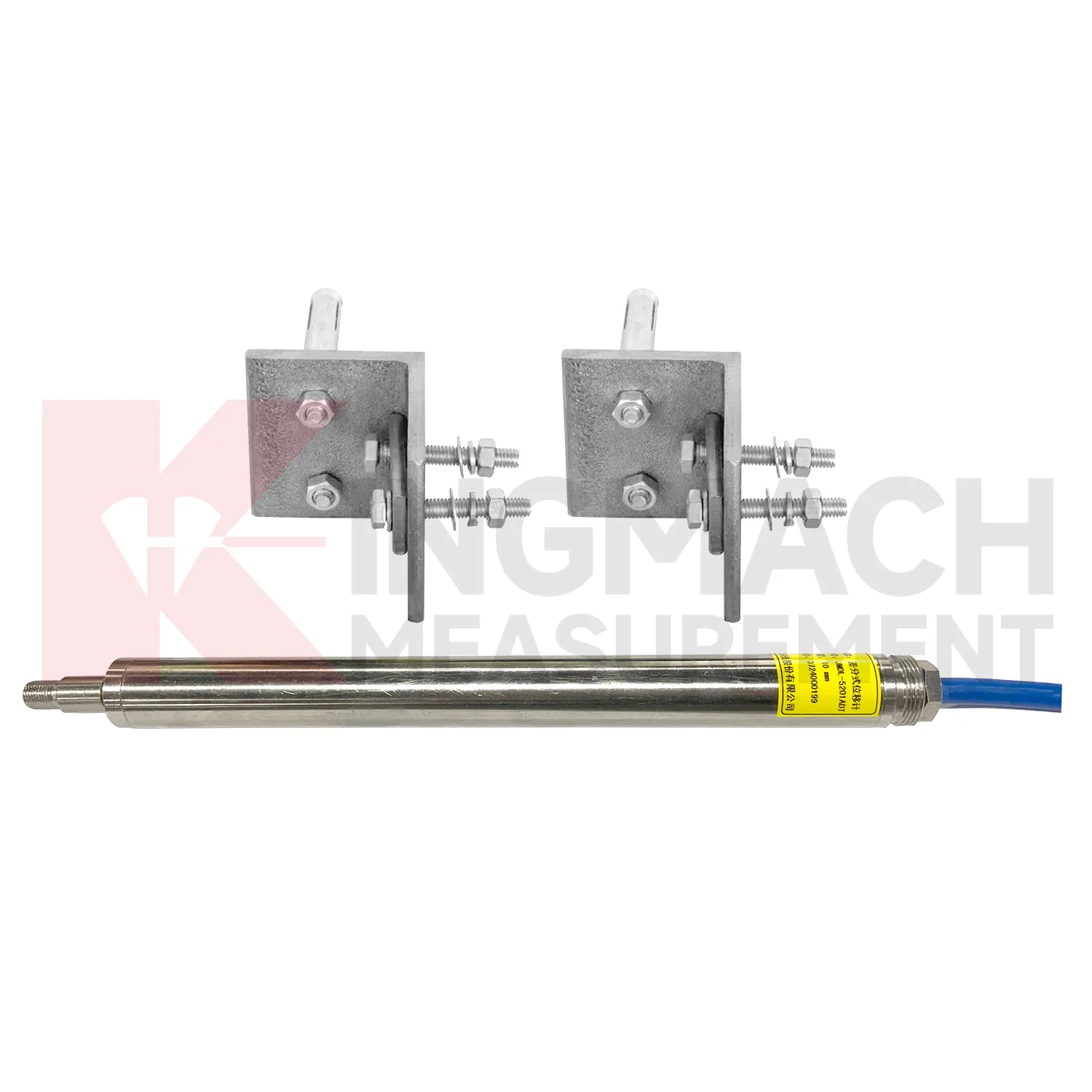
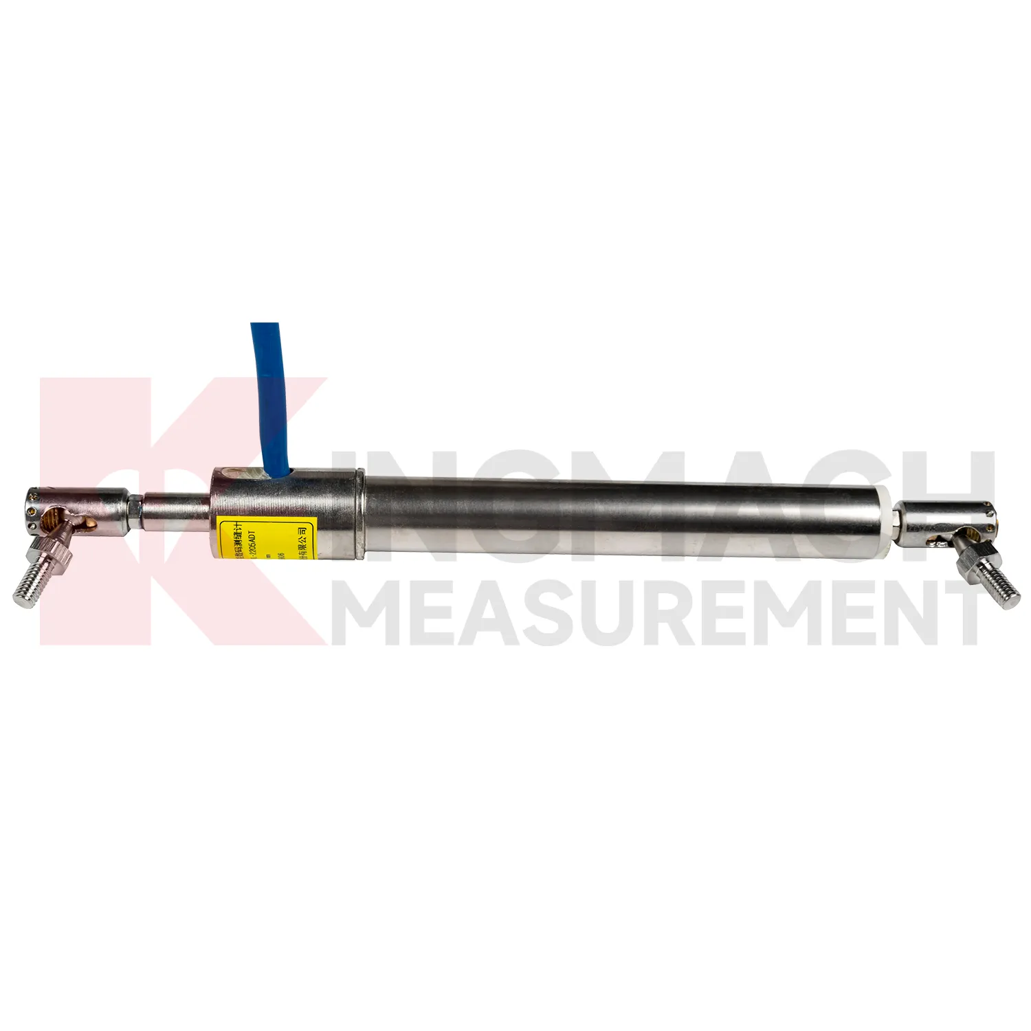
The JMDL-52XXADT Differential Displacement Meter is one of the higher precision Kingmach Integrated GNSS for structural joints and relative movement. It uses two coupled inductive coils. As the measuring rod moves, magnetic flux changes in the two coils are equal in magnitude and opposite in direction, and the difference is calculated to reduce environmental interference and thermal drift. Listed ranges are 20 mm, 50 mm, and 100 mm. The product provides 0.01 mm resolution, plus or minus 0.1%FS accuracy, RS485 digital output, DC 9V to 24V supply, power consumption below 0.4 W, long-term stability of plus or minus 0.1%FS per year, and an operating temperature range from -40 degrees Celsius to +80 degrees Celsius. Temperature drift is listed as 0.001 mm per degree Celsius. These specifications are useful for bridges, railways, hydropower structures, dams, and buildings where small relative movement needs to be measured across seasons and load changes. During project setup, the measuring point should be matched with the expected travel direction, available mounting space, cable route, and required acquisition interval. This prevents a short-range joint instrument from being used on a long-travel point, or an exposed sensor from being placed where an embedded anchor is needed. It also helps the monitoring team set a baseline that can be defended during acceptance and later maintenance review.

Application of Integrated GNSS
In industrial automation and equipment monitoring, Integrated GNSS are used for hydraulic cylinder stroke, machine tool positioning, gate movement, construction machinery displacement, and linear motion control. The site pain point is different from civil monitoring: readings must often be fast, absolute, repeatable, and resistant to wiring mistakes or mechanical wear. Kingmach JMCW-21XXADT magnetostrictive meters provide non-contact absolute displacement measurement over 0 to 1000 mm, 0.01 mm resolution, plus or minus 0.05%FS accuracy, RS485 communication, IP67 protection, average current below 60 mA, and reverse polarity protection up to -36V. For equipment with cable travel, JMLS-22XXADT wire rope sensors provide 500 mm, 1000 mm, and 2000 mm ranges with 0.2%FS accuracy and compact dimensions of 115 mm by 85 mm by 100 mm. These products help operators track position drift, stroke limits, gate opening, and machine movement in harsh workshops or outdoor installations. During operation, the monitoring team should keep the baseline, temperature, inspection notes, and nearby sensor behavior in the same review file. This makes it easier to tell whether a movement trend comes from normal service, a repair event, changing load, water influence, or developing structural risk. Clear records also help owners decide when a field inspection is needed instead of waiting for visible damage.
The future of Integrated GNSS
The future of Integrated GNSS will be shaped by connected monitoring rather than isolated field readings. Kingmach products already include digital detection, RS485 communication on selected models, built-in memory, stored calibration data, and compatibility with automatic acquisition systems. The next practical step is cleaner connection between the sensor identity, the monitoring point, and the platform curve. A displacement value should arrive with its model, serial number, range, calibration coefficient, zero value, temperature, and installation position. That will reduce channel errors and make later review faster. In bridges, tunnels, dams, slopes, and foundation pits, future systems will compare displacement with strain, load, tilt, settlement, rainfall, water level, and construction events. Warnings will depend less on a single limit and more on the pattern of movement across several related sensors. The strongest systems will still depend on careful installation, because digital tools cannot correct a loose bracket, wrong range, or poorly recorded baseline. Clear reporting will make displacement monitoring more useful for non-specialist decision makers while preserving the detail engineers need.
Care & Maintenance of Integrated GNSS
For differential Integrated GNSS, maintenance should preserve the geometry that makes high precision possible. Kingmach JMDL-52XXADT uses two coupled inductive coils to reduce environmental interference and thermal drift. The product lists 20 mm, 50 mm, and 100 mm ranges, 0.01 mm resolution, plus or minus 0.1%FS accuracy, RS485 output, low power consumption, and -40 degrees Celsius to +80 degrees Celsius operating temperature. During installation, align the measuring rod so it moves freely without side load or rubbing. Protect the device from impact at expansion joints and from water pooling around connectors. During service, compare readings across temperature cycles and confirm that movement returns as expected when the structure cools or unloads. A persistent offset may indicate structural change, bracket movement, or cable trouble. Keep yearly stability checks and calibration records with the monitoring database, not only in paper files. Keep the installation photo, point number, zero value, and expected movement direction with the commissioning record for later review. If a reading changes after maintenance work, inspect the base, anchor, cable, and cabinet before assuming the structure itself has moved.
Kingmach Integrated GNSS
Long-term projects need Integrated GNSS that can survive the same weather, vibration, cable pulling, and site handling as the structure itself. Kingmach designs several smart displacement products with built-in memory chips, digital detection, strong anti-interference capability, and direct display through compatible testers. The JMDL-22XXAT crack gauge stores up to 600 measurement results and covers 20 mm, 50 mm, 100 mm, and 200 mm models. The JMDL-21XXAT general-purpose model stores up to 800 records and can save time, temperature, absolute displacement, relative displacement, and zero-point values. These records matter during handover because the original baseline, later shifts, and abnormal readings can be checked without relying only on handwritten notes. For bridges, dams, tunnels, slopes, and buildings, that traceability helps maintenance teams judge whether a movement event is isolated, repeated, or linked with surrounding construction and environmental change. The point should be named on the drawing, linked with its cable route, and checked against the expected movement direction before the first automatic reading is accepted. For daily review, the reading should be compared with nearby points, recent weather, site operations, and any loading event that could explain the movement.
FAQ
Q: How should Integrated GNSS be maintained?
A: Inspect brackets, anchors, measuring rods, cable routes, connectors, waterproof seals, cabinet wiring, grounding, and channel labels at planned intervals.
Q: What signs suggest a data problem rather than real movement?
A: Flat lines, sudden jumps after cabinet work, repeated communication gaps, impossible readings, or disagreement with nearby points may indicate sensor, cable, power, or channel issues.
Q: Can temperature affect displacement data?
A: Yes. Some products include low temperature sensitivity, differential measurement, or temperature records, but temperature should still be reviewed with the movement trend.
Q: Should zero values be reset often?
A: No. Resetting without a field reason can hide structural movement. Record the event, reason, and new baseline if a reset is required.
Q: What makes a displacement record useful during handover?
A: A useful record includes model, range, serial number, calibration coefficient, baseline, installation photo, point location, latest trend, warning level, and maintenance notes.
Reviews
Andrew Lee
The visualization software is intuitive and powerful. It helps us analyze monitoring data efficiently.
Joshua Clark
We ordered a full monitoring solution including sensors and data loggers. Everything works seamlessly together. Great supplier!
Latest Inquiries
To protect the privacy of our buyers, only public service email domains like Gmail, Yahoo, and MSN will be displayed. Additionally, only a limited portion of the inquiry content will be shown.
Isabella***@gmail.comGermany
Hello, we are evaluating weir flow meters for a water management project. Please share accuracy deta...
Ava***@gmail.comAustralia
Hi, I am looking for reliable tiltmeters and accelerometers for structural health monitoring. Please...
Related product categories
- displacement sensor
- laser displacement sensor
- displacement sensors
- linear displacement sensor
- optical displacement sensor
- wireless displacement sensor
- laser displacement sensors
- non contact displacement sensor
- cable displacement sensor
- draw wire displacement sensor
- inductive displacement sensor
- lvdt displacement sensor