 ar
ar bg
bg hr
hr cs
cs da
da nl
nl fi
fi fr
fr de
de el
el hi
hi it
it ko
ko no
no pl
pl pt
pt ro
ro ru
ru es
es sv
sv tl
tl iw
iw id
id lv
lv lt
lt sr
sr sk
sk sl
sl uk
uk vi
vi et
et hu
hu th
th tr
tr fa
fa ms
ms hy
hy ka
ka ur
ur bn
bn mn
mn ta
ta kk
kk uz
uz ku
ku
Inclinometer-based Hydrostatic Leveling System
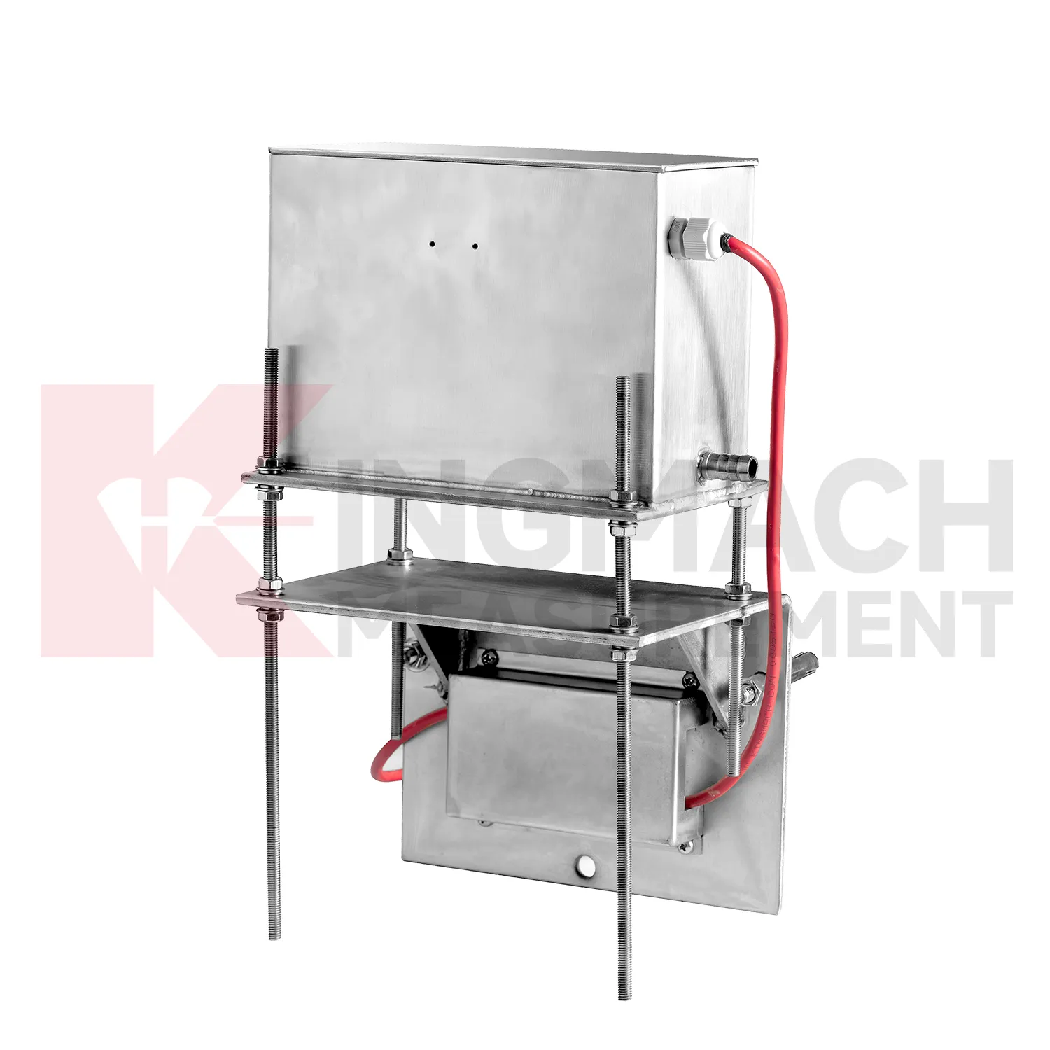
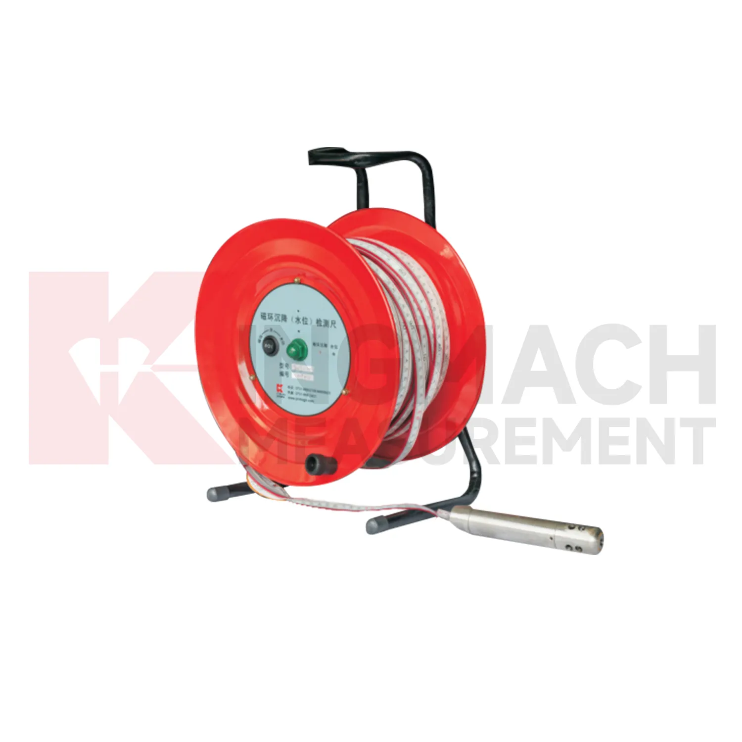
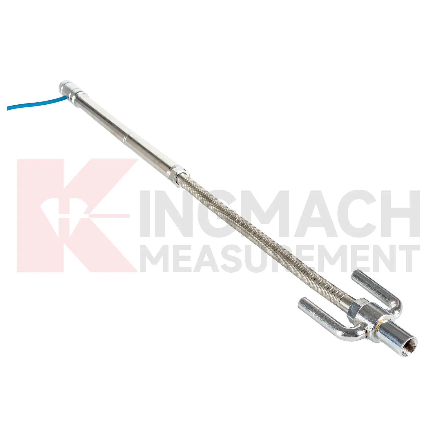
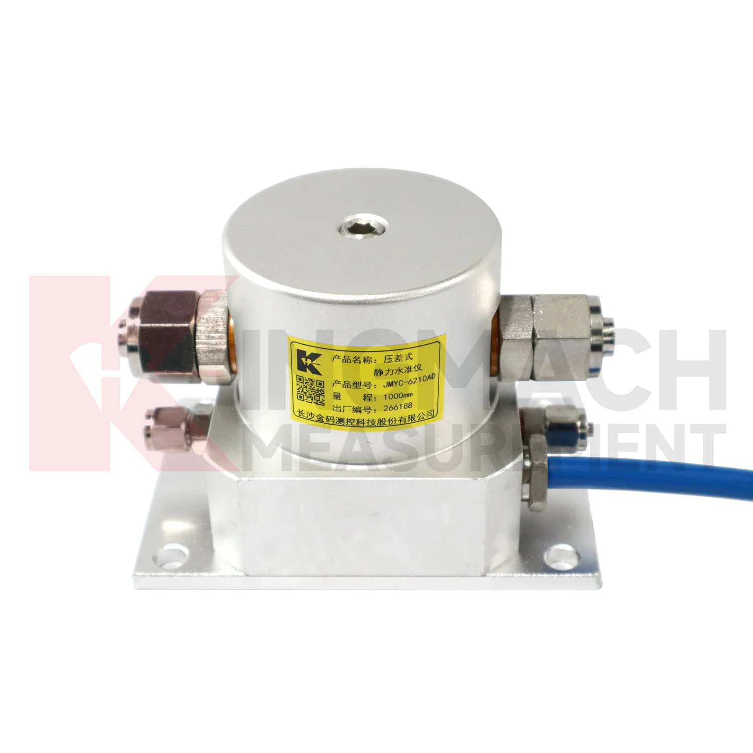
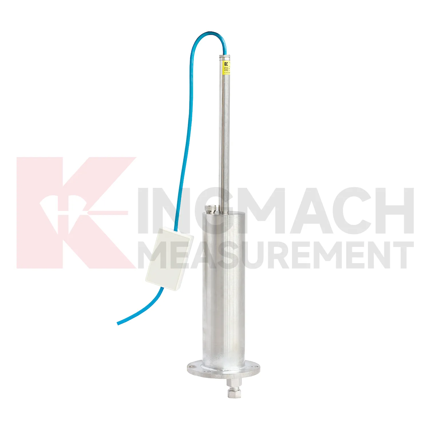
Selecting Kingmach Inclinometer-based Hydrostatic Leveling System begins with the scale and shape of expected movement. A single embedded point, a hydrostatic comparison line, a wide-range profile, and a magnetic ring borehole answer different questions. JMDL-47XXAT covers 100 mm to 400 mm embedded settlement. JMDL-62XXADT and JMQJ-62XXADT provide 0.01 mm hydrostatic resolution for smaller vertical changes. JMYC-62XXAD covers 500 mm to 4000 mm with 0.1 mm resolution and 0.2%FS accuracy for larger movement. JMCJ-1003/1005 provides plus or minus 1 mm depth reading for magnetic ring settlement and water level checks. Selection should consider whether the structure will remain accessible, whether groundwater is part of the risk, whether automatic collection is required, and whether the reference point can remain stable for the full observation period. A short-range high-resolution instrument is not automatically better if the site may move beyond its travel. A large-range system is not always best if the project needs very small early warnings.
Application of Inclinometer-based Hydrostatic Leveling System
In foundation pit projects, Inclinometer-based Hydrostatic Leveling System are used during staged excavation to track base uplift, nearby pavement settlement, groundwater response, and vertical movement around retaining systems. The timing of each value matters because deformation may change after dewatering, support installation, soil removal, rainfall, or backfilling. Kingmach JMDL-47XXAT can be embedded to follow base uplift or local settlement, while JMCJ-1003/1005 can read magnetic ring depth and groundwater level in boreholes. Hydrostatic instruments may be added where several elevations around the pit need comparison against a reference. The site team should record excavation depth, support level, water pumping condition, adjacent road or building observations, and first stable baseline beside the settlement curve. If movement grows quickly, the response should include checking the sensor and reference first, then comparing support force, wall displacement, groundwater, and visual inspection before deciding whether excavation can continue. This keeps settlement review tied to the actual construction sequence, which is essential because a pit may behave differently at each excavation depth and support stage. A clear record also helps distinguish base rebound from surrounding ground loss or reference disturbance. The review file should also include reference condition, recent site work, nearby sensor behavior, and inspection notes so later teams can interpret the curve clearly.
The future of Inclinometer-based Hydrostatic Leveling System
The future of Inclinometer-based Hydrostatic Leveling System will give more attention to reference-point control. Hydrostatic leveling systems calculate vertical deformation by comparing measuring points against a reference, so the reference must be protected, inspected, and named clearly in the platform. Kingmach products such as JMDL-62XXADT, JMQJ-62XXADT, and JMYC-62XXAD already support multi-point settlement measurement through connected liquid paths and digital output. Future systems can record reference sensor status, water pipe condition, temperature, zero value, and maintenance events together with each settlement curve. This will help engineers avoid confusing reference drift with real subgrade, bridge, dam, or building movement. Better reference records will also make handover easier when a project moves from construction control to long-term operation. The practical goal is to keep settlement data understandable after the original installation crew has left, so owners can compare old and new readings without reconstructing the field history from memory. The same record should remain readable for designers, contractors, owners, and maintenance teams, because settlement monitoring often continues long after the first construction report is finished.
Care & Maintenance of Inclinometer-based Hydrostatic Leveling System
Trend review for Inclinometer-based Hydrostatic Leveling System should include the surrounding engineering story. Settlement may respond to filling height, excavation depth, dewatering, rainfall, groundwater, reservoir level, traffic loading, concrete curing, or nearby construction. A sudden change may be real, but it may also come from disturbed tubes, moved reference points, loose cables, weak batteries, or manual reading error. Compare each curve with nearby displacement, tilt, strain, load, pore pressure, and water level data when available. For long-term projects, review rate of change as well as total settlement. A small value that keeps accelerating may matter more than a larger value that has stabilized. Maintenance staff should flag date, likely trigger, nearby work, inspection result, and follow-up action in the same record. That habit makes the curve useful during design review, safety meetings, and later handover.
Kingmach Inclinometer-based Hydrostatic Leveling System
For procurement and technical selection, Inclinometer-based Hydrostatic Leveling System should be matched to expected movement scale, access, and monitoring method. A micro range hydrostatic sensor with 0.01 mm resolution is not the same tool as a wide-range differential pressure sensor covering up to 4000 mm, and neither replaces a magnetic ring gauge used for borehole layer readings. Kingmach's category includes JMDL-47XXAT, JMDL-62XXADT, JMQJ-62XXADT, JMYC-62XXAD, and JMCJ-1003/1005, each aimed at a different settlement task. Before ordering, engineers should define whether the point is embedded, connected by water tube, manually probed, remotely acquired, or compared with a reference sensor. The best specification starts with the field question, then selects the instrument. Procurement teams should therefore ask not only for range and accuracy, but also for installation method, reading method, protection level, and data handover format. Procurement teams should therefore ask not only for range and accuracy, but also for installation method, reading method, protection level, and data handover format.
FAQ
Q: What is JMCJ-1003/1005 used for?
A: It is used to measure layered underground settlement and groundwater level in foundations, subgrades, foundation pits, embankments, and underground structures.
Q: How does magnetic ring settlement reading work?
A: Magnetic rings are placed underground; when the probe senses a ring, audible and visual alerts help the operator read depth from the steel tape at the borehole.
Q: How is water level detected?
A: The water level component works by water conductivity and alerts when the probe contacts water.
Q: What accuracy is listed?
A: The listed measurement accuracy is plus or minus 1 mm.
Q: What field records are needed?
A: Keep borehole number, magnetic ring depth, previous reading, current reading, groundwater level, and operator notes together.
Reviews
David Wilson
We purchased displacement transducers and settlement sensors, and the quality exceeded our expectations. Easy installation and reliable performance.
Joshua Clark
We ordered a full monitoring solution including sensors and data loggers. Everything works seamlessly together. Great supplier!
Latest Inquiries
To protect the privacy of our buyers, only public service email domains like Gmail, Yahoo, and MSN will be displayed. Additionally, only a limited portion of the inquiry content will be shown.
Olivia***@gmail.comUnited States
Hello, we are currently sourcing high-precision strain gauges and load cells for a bridge monitoring...
Ava***@gmail.comAustralia
Hi, I am looking for reliable tiltmeters and accelerometers for structural health monitoring. Please...